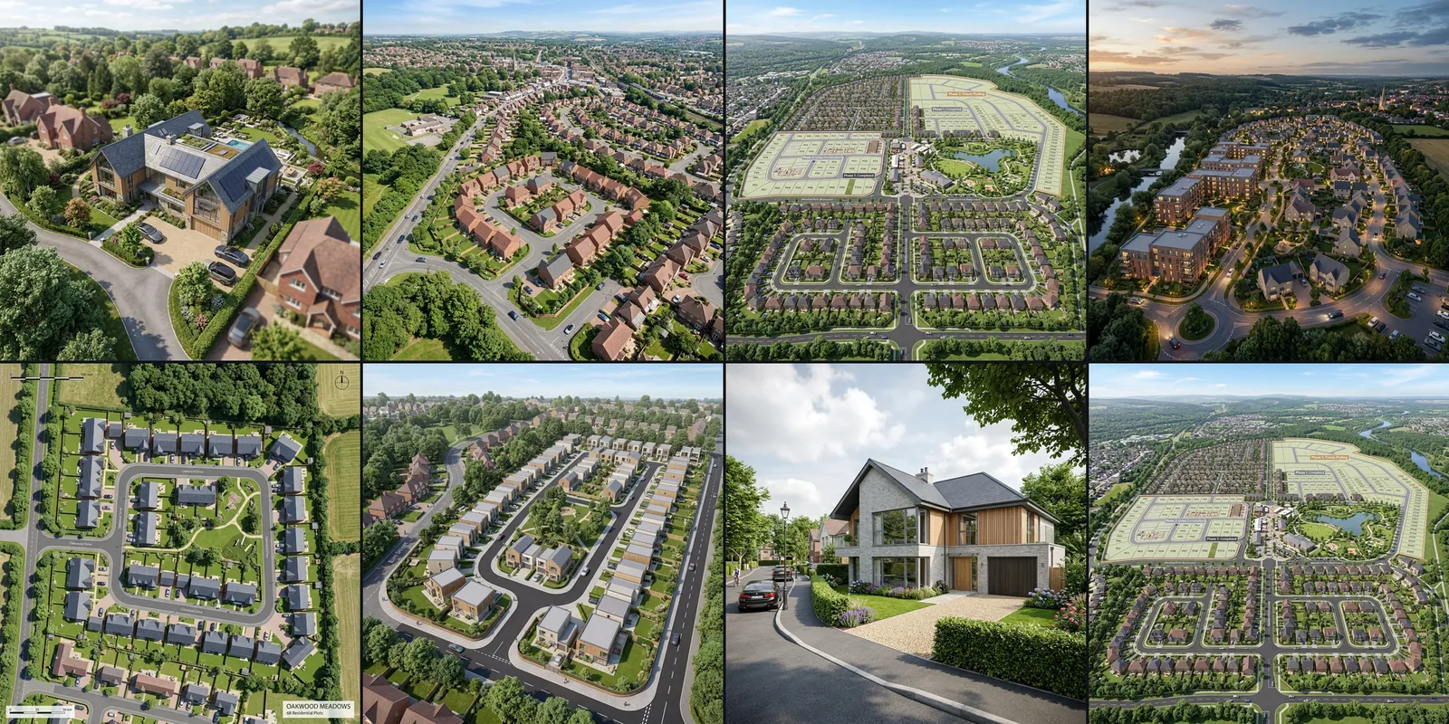
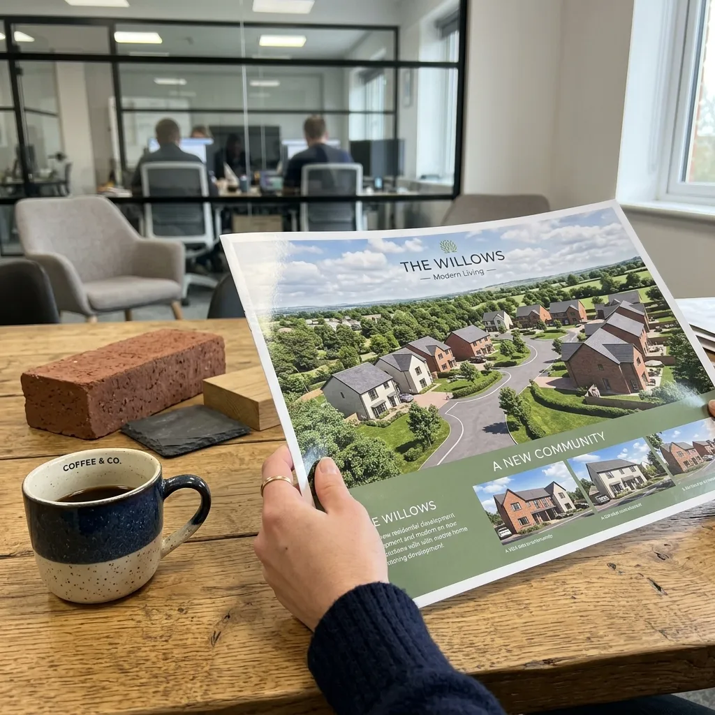
Aerial CGI for Planning, Marketing and Sales
An aerial view render is a bird's-eye or elevated CGI of your scheme, built from your drawings and CAD. No drone flight required, photoreal, and ready for planning submissions, marketing brochures and sales boards.
How it works
You send us your site plan, floor plans and elevations. We model the building and its surroundings, then place a camera high above the site to produce the aerial view. Because it is CGI, we can show a proposed scheme before a single brick is laid, set it in its site context, and adjust the angle, height and time of day until the view is clear.
Pairs with
These views pair with our exterior renderings and support planning application drawings. The 3D model behind each view comes from our 3D modelling service.
What an Aerial View Render Shows
Site context, massing and masterplan, neighbouring buildings, roofscape and landscaping, all in one image.
Massing and Built Form
Your building modelled in 3D and seen from above
- Building footprint and massing
- Neighbouring buildings
- Gardens and landscaping
- Roofscape and rooftop detail
Site Context
Your scheme shown within its real surroundings
- Streets and access roads
- Neighbouring plots and buildings
- How the scheme sits in its plot
- Wider area for context
Masterplan and Layout
Multi-plot and phased schemes seen as a whole
- Whole masterplan in one view
- Road layout and plot boundaries
- Phasing shown by area
- Landscaping and public realm
Ready for Planning and Sales
Photoreal output sized for every use
- Photoreal, high-resolution images
- Several angles and heights
- Daytime or dusk lighting
- Print and web-ready formats
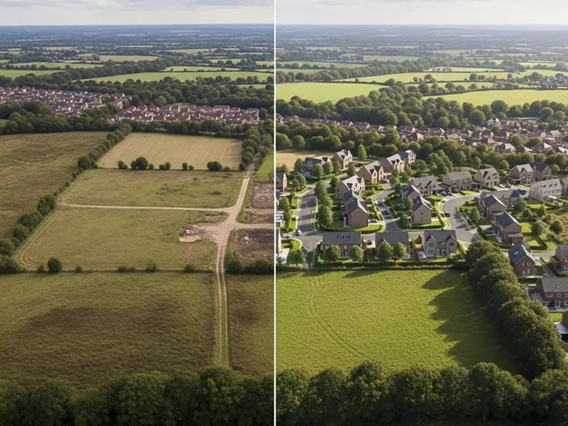
One Image, the Whole Picture
Your scheme, its plot and its surroundings in a single aerial view
Massing and Built Form
Building footprints, roofscape and landscaping, read from above in one image.
Set in Its Real Surroundings
The scheme placed in its real streets, access roads and neighbouring plots.
Masterplan and Layout
Phases, road grid, plot boundaries and the public realm across a whole site.
Dusk View for Planning and Sales
A golden-hour aerial with lit windows, ready for planning packs and marketing.
Aerial and masterplan CGI earns its place on larger schemes. We use it to present office developments, commercial projects and waterfront and mixed-use sites to planning committees and buyers. For a moving bird's-eye tour of the same scheme, add an aerial flythrough animation.
Bird's-Eye, Elevated and Eye-Level Views
We set the camera at the height and angle that suits the job, because the model is built in 3D.
Bird's-eye view
Looking straight down or close to it. Best for showing the masterplan, plot boundaries, roofscape and how the layout works across the whole site.
Elevated, high-angle view
A raised, tilted camera, the angle most drone photos use. It shows massing and built form while keeping the surrounding streets and neighbouring buildings in frame.
Eye-level view
A street-level camera for approach and entrance shots. We often pair one aerial with one eye-level view so people read both the layout and the experience.
From Your Drawings to an Aerial View
No flight, no weather window, no permissions. We model your scheme and place the camera above it.
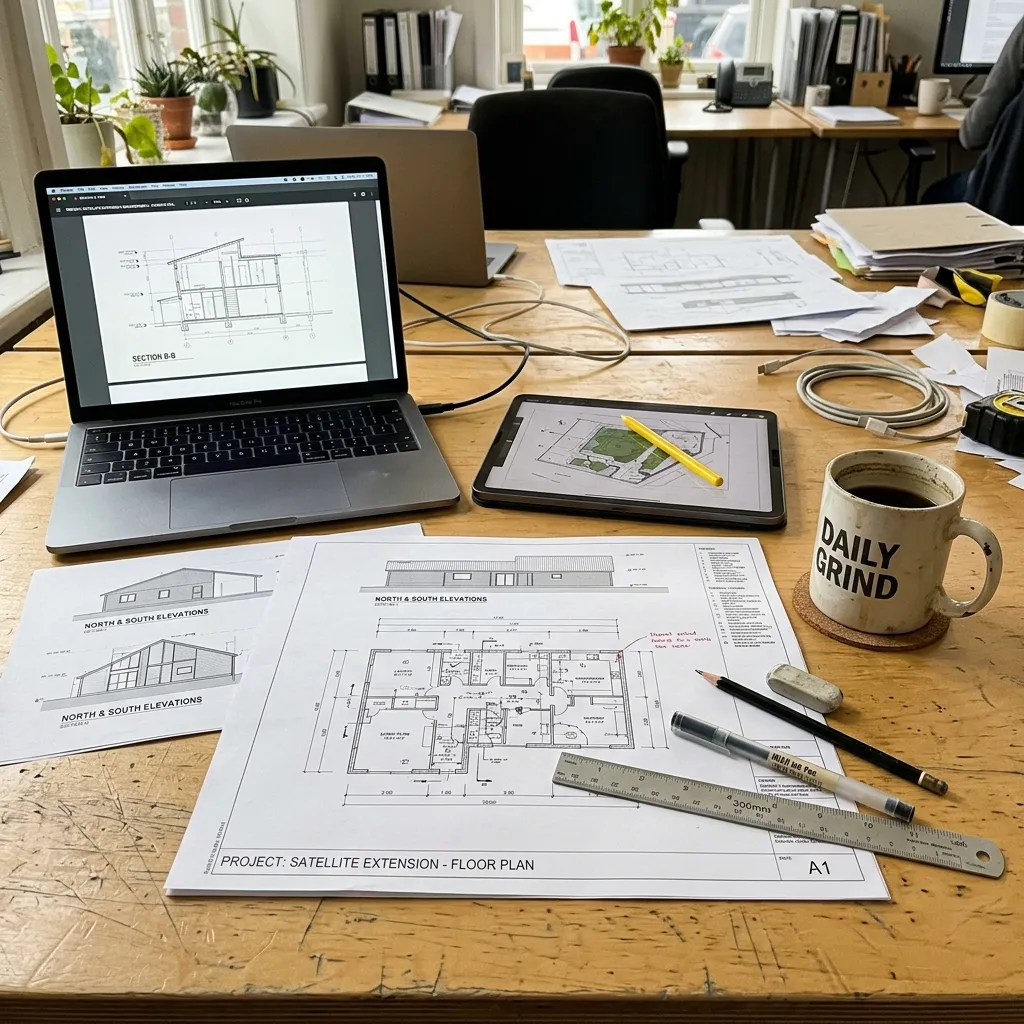
Send us your drawings
Site plan, floor plans and elevations, in CAD or PDF, plus any materials or planting notes.
We build the 3D model
Building, plot, neighbouring buildings, roads and landscaping, modelled to match your drawings.
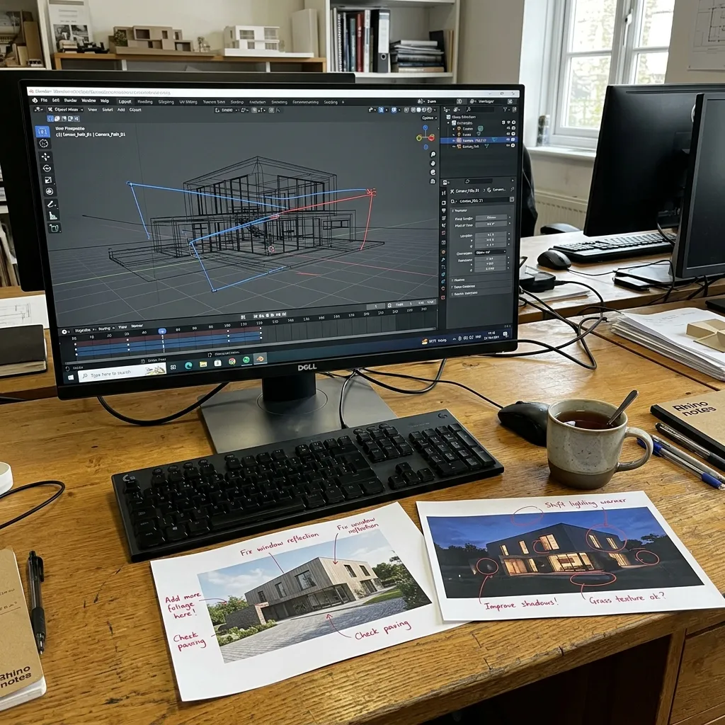
We set the aerial camera
You pick the height and angle. We light the scene for daytime or dusk and you review a draft.
You get the final views
Photoreal aerial renders, sized for planning, brochures and sales boards.
The difference from a real drone flight: an aerial render does not need a clear sky, a flight slot or CAA permissions, and it can show a building that is not built yet. A real drone can only photograph what already stands on site today. For built schemes we can arrange real drone capture too, covered lower down this page.
Aerial CGI Pricing
Pick the view that fits your scheme: one building from above, that same building shown in its street, or the whole masterplan. We price per view, and the figure firms up from how many views you need and how much detail.
Bird's-eye CGI, single building
One building modelled and shown from above. Good for a single house, extension or small block.
Pick this if you need one building shown from above.
Site-context aerial
The building plus its surroundings: neighbouring plots, roads and landscaping in the same image.
Pick this if planners or buyers need to see how the scheme sits in its street.
Masterplan or development aerial
Multi-plot and phased schemes shown as a whole. Priced by the size and detail of the masterplan.
Pick this if you are presenting a multi-plot or phased development.
Prices follow our exterior CGI rates and scale with the number of views and the detail. Use the price calculator for a figure on your project, or request a quote with your drawings.
Real Drone Photography We Arrange
Already built? We can also arrange a CAA-certified drone pilot to photograph the real thing. The aerial CGI above is modelled from your drawings and needs no flight, so this is the option when the building is already standing on site.
Important Package Information
Raw Files & Professional Editing
All packages include raw, unedited photos and videos. Professional editing is available:
Professional Editing: £500 per package
Includes colour correction, stabilisation and final output
Video Storyboard Requirements
- Essential Package: No video footage included
- Professional Package: Client must provide storyboard OR we can create one
- Premium Package: Professional storyboard creation included
* All turnaround times begin AFTER location permissions are secured
* Weather dependent and subject to CAA regulations
* Restricted zones may add 7 to 28 days to timeline
* Travel costs may apply for locations outside our standard service area


Ongoing service
Progress Drone Photography for Live Builds
On a larger or phased build, one shoot is not enough. We come back on a set schedule, weekly, monthly or per phase, and shoot the site from the same angles each time. You get a dated record of the whole build from the air, the way the slider shows it.
- A repeat visit weekly, monthly or per phase, to suit the programme
- Same camera positions every time, so the timeline lines up
- Dated images and video for funders, marketing and board updates
- Pairs with aerial CGI to show the finished scheme next to today's progress
Priced per visit or as a monthly retainer, set by the site and how often you need us.
Why Add Real Drone Photography?
For a site that is already built, a real drone flight records the place as it stands today
Complete Property Overview
Show the entire property, grounds, and surrounding area in a single compelling image
Location Context
Highlight proximity to amenities, transport links and neighbouring buildings
True Scale & Proportion
Give viewers an accurate sense of property size and layout from above
Professional & Compliant
All flights conducted by CAA certified pilots with full insurance coverage
CAA Regulations and Flight Restrictions
These apply to the real drone flights we arrange. They do not apply to aerial CGI, which needs no flight.
Restricted Zones & Permissions
- •Airports & Airfields: No flights within 5km without ATC permission
- •Flight Restriction Zones: Special permissions required (7 to 28 days)
- •Congested Areas: Additional safety assessments needed
- •Protected Sites: Some locations may be completely prohibited
Timeline Implications
- •Standard locations: 5 to 7 days from booking
- •Near airports: +7 to 14 days for permissions
- •Restricted zones: +14 to 28 days for approvals
- •Timeline starts: After location approval confirmed
Important: All turnaround times quoted in packages begin AFTER we receive necessary permissions and clearances
How We Handle Restrictions
Location Check
We verify your property location against CAA restrictions
Permission Application
We handle all necessary permits and clearances
Timeline Confirmation
We provide accurate delivery dates after approvals
Planning a Real Drone Shoot
What we coordinate when a real drone flight is the right add-on
Weather Conditions
Optimal shooting conditions matter
- • Wind speed under 20mph
- • Clear or partly cloudy best
- • Golden hour for warmth
- • Flexible scheduling available
Legal Compliance
Fully certified and insured
- • CAA certified pilots
- • £5m public liability
- • Flight permissions handled
- • Risk assessments provided
Preparation Tips
Get the best results
- • Tidy outdoor areas
- • Remove/hide bins
- • Open curtains/blinds
- • Consider staging areas
Aerial CGI or Drone Photography? Combining Both
Use aerial CGI for a proposed or unbuilt scheme, real drone photography for what is already on site, or both together.
When to Use Each, and How They Work Together
Aerial CGI shows a scheme that is not built yet, set in its site context, with full control of angle and lighting. A real drone photographs a finished building as it stands. When a site is built, we can composite your CGI onto a real drone plate so a new phase or extension sits in genuine surroundings.
- Show proposed and unbuilt schemes from above
- Support planning applications with clear context
- Market off-plan homes before they are built
- Composite CGI onto real drone plates of built sites
Aerial View Rendering FAQs
What is an aerial view render?
It is a bird's-eye or elevated CGI of your building, modelled from your drawings and CAD. We place a virtual camera high above the scheme to produce a photoreal image, with no drone flight involved.
Aerial CGI or a drone photo: what is the difference?
Aerial CGI is built in 3D, so it can show a scheme before it is built and gives full control of angle, height and lighting. A drone photo records a real, finished building on the day of the flight. For unbuilt schemes you need CGI.
Can you show my scheme in its real surroundings?
Yes. We model the neighbouring buildings, roads and landscaping so the aerial render reads as site context. For a built site we can also composite your CGI onto a real drone photograph of the location.
Do you need a drone flight to make an aerial view?
No. Aerial CGI needs no flight, no clear-sky weather window and no CAA permissions. We only arrange a real drone flight when you want photography of a site that is already built.