Drone & Aerial Photography
Elevate your property marketing with stunning aerial perspectives and professional drone photography as part of our complete visualization services
Professional Aerial Photography Services
CAA certified drone pilots capturing your property from every angle
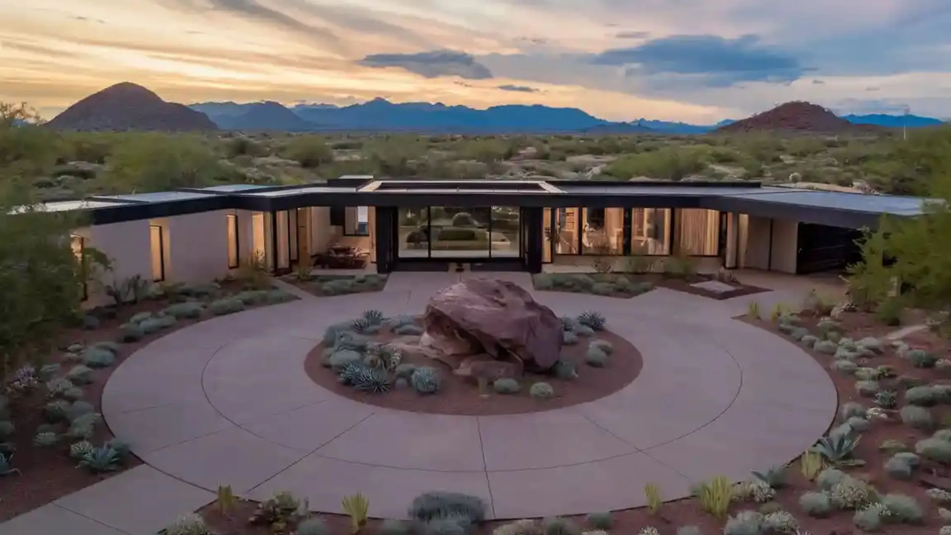
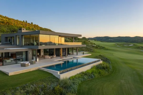
Real Estate Aerials
Showcase properties from stunning elevated perspectives
- Property overview shots
- Neighborhood context
- Garden & grounds coverage
- Roof condition documentation
Site Context Photography
Capture the surrounding area and local amenities
- Transport links visibility
- Local amenities mapping
- Development potential views
- Area overview shots
Construction Progress
Document building progress from unique aerial angles
- Monthly progress updates
- Site logistics overview
- Safety documentation
- Marketing materials
CGI Integration Ready
Aerial photography perfect for CGI backgrounds and context
- High-res site photography
- Multiple angle coverage
- Seasonal variations
- CGI-ready formats (CGI service separate)
Professional Results Every Time
Capturing your property from the perfect angle
Aerial Photography Packages
Professional drone photography services to showcase your property from above
Important Package Information
Raw Files & Professional Editing
All packages include raw, unedited photos and videos. Professional editing is available:
Professional Editing: £500 per package
Includes color correction, stabilization, and final output
Video Storyboard Requirements
- Essential Package: No video footage included
- Professional Package: Client must provide storyboard OR we can create one
- Premium Package: Professional storyboard creation included
* All turnaround times begin AFTER location permissions are secured
* Weather dependent and subject to CAA regulations
* Restricted zones may add 7-28 days to timeline
* Travel costs may apply for locations outside our standard service area
Why Choose Aerial Photography?
Aerial views provide unique perspectives that ground-level photography simply can't capture
Complete Property Overview
Show the entire property, grounds, and surrounding area in a single compelling image
Location Context
Highlight proximity to amenities, transport links, and neighborhood features
True Scale & Proportion
Give viewers an accurate sense of property size and layout from above
Professional & Compliant
All flights conducted by CAA certified pilots with full insurance coverage
CAA Regulations & Flight Restrictions
Understanding UK aviation regulations and how they affect your drone photography project
Restricted Zones & Permissions
- •Airports & Airfields: No flights within 5km without ATC permission
- •Flight Restriction Zones: Special permissions required (7-28 days)
- •Congested Areas: Additional safety assessments needed
- •Protected Sites: Some locations may be completely prohibited
Timeline Implications
- •Standard locations: 5-7 days from booking
- •Near airports: +7-14 days for permissions
- •Restricted zones: +14-28 days for approvals
- •Timeline starts: After location approval confirmed
Important: All turnaround times quoted in packages begin AFTER we receive necessary permissions and clearances
How We Handle Restrictions
Location Check
We verify your property location against CAA restrictions
Permission Application
We handle all necessary permits and clearances
Timeline Confirmation
We provide accurate delivery dates after approvals
Planning Your Aerial Shoot
Important considerations for successful aerial photography
Weather Conditions
Optimal shooting conditions matter
- • Wind speed under 20mph
- • Clear or partly cloudy best
- • Golden hour for warmth
- • Flexible scheduling available
Legal Compliance
Fully certified and insured
- • CAA certified pilots
- • £5m public liability
- • Flight permissions handled
- • Risk assessments provided
Preparation Tips
Get the best results
- • Tidy outdoor areas
- • Remove/hide bins
- • Open curtains/blinds
- • Consider staging areas
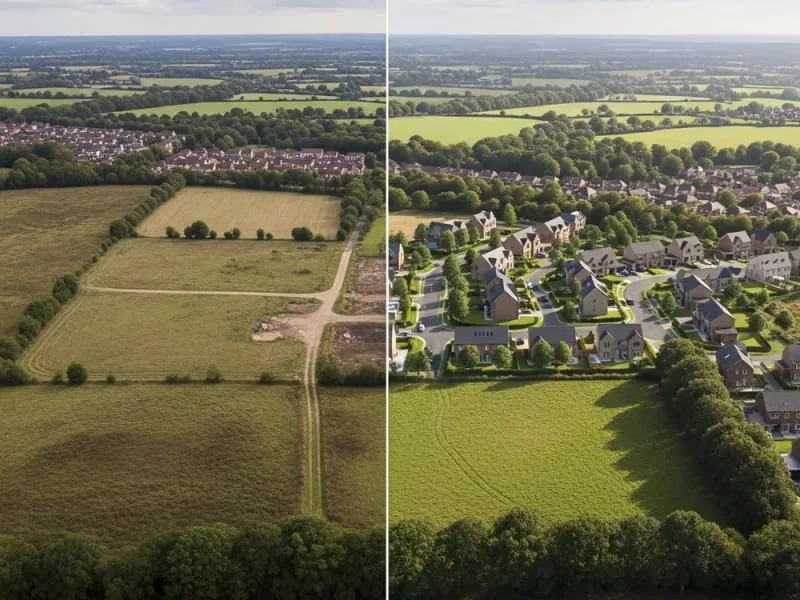
Perfect for CGI Integration
Our aerial photography seamlessly integrates with our 3D visualization services
Aerial Photography + CGI = Perfect Marketing
Combine real aerial photography with CGI to show proposed developments in their actual context. This powerful combination helps stakeholders visualize the final project.
- Show future developments in real locations
- Perfect for planning applications
- Ideal for marketing off-plan properties
- Show different design options in context