3D Architectural Visualization Newcastle
3D architectural visualisation for Newcastle turns plans, elevations and sections into photoreal CGI of a building before construction starts, for sites in the city and across the North East. Architects, developers and homeowners receive exterior, interior and aerial views, planning photomontages and 3D models, with every drawing, comment and final image exchanged online.
Architectural CGI Services for Newcastle Projects
Architectural CGI for Newcastle projects comes as six services, each fitted to a stage of the scheme such as design review, planning, pre-sales or letting. A single 3D model feeds every service, so the planning photomontage and the marketing render of the same building match in massing, materials and light.
Exterior CGI
Street, garden and dusk views of houses, apartment blocks and commercial buildings, with materials taken from the specification.
Exterior CGI and 3D renderingInterior CGI
Kitchens, living rooms, bathrooms and show-flat interiors rendered with the chosen finishes, joinery and furniture before fit-out begins.
Interior CGIsAerial CGI
Elevated views that show a housing estate, campus or riverside scheme with its roads, landscaping and neighbouring buildings.
Aerial and bird's-eye CGIPlanning visuals
Illustrative CGIs and photomontages submitted with the drawings, showing the proposal from viewpoints a case officer recognises.
CGI for planning applicationsHouse extension CGI
Rear, side, wrap-around and loft extension views that set the new rooms against the existing terrace, semi or detached house.
House extension visualisations3D modelling
3D models built from PDF, DWG and other CAD drawings, used for design checks, client sign-off and rendering.
Architectural 3D modellingPlanning visuals carry the most Newcastle-specific detail, because the case officer reads them against the street, the conservation area and the local plan.
Planning CGI for Newcastle City Council and Neighbouring Authorities
Planning CGI for Newcastle consists of illustrative CGIs and photomontages submitted with the drawings to show how a proposal sits in its real street. Newcastle City Council decides applications inside the city. The first part of its local plan, the Core Strategy and Urban Core Plan, was prepared jointly with Gateshead Council and adopted by Newcastle City Council on 26 March 2015.
Gateshead, North Tyneside, South Tyneside, Sunderland, Northumberland and County Durham councils decide applications in the rest of the North East Combined Authority area. Northumberland National Park has its own planning authority for sites inside the park.
An illustrative CGI presents the design intent, showing materials, massing and landscaping from an agreed viewpoint. A verified photomontage matches the 3D model to a surveyed photograph with a recorded camera position, and it is prepared when survey data for the site is supplied.
Newcastle has 12 conservation areas, and their buildings set the standard for an extension, roof or infill CGI. Richard Grainger's Georgian developments line Grey Street, Grainger Street and Clayton Street in the Central Conservation Area. Summerhill is a late Georgian suburb of listed terraces, and Gosforth holds High Victorian, Queen Anne Revival and Edwardian houses.
The Planning Photomontage of a Camden Infill Block shows the finished format, and the 3D visualisation for planning applications page sets out the method.
Tyneside flats
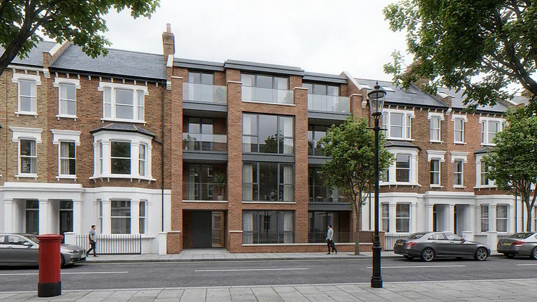
Tyneside flats line terraced streets across Tyneside. Built widely from the 1860s and 1870s, each building holds a ground-floor flat and an upper flat, and almost all have two front doors side by side. A loft or rear extension CGI for a Tyneside flat shows the change to that shared frontage, roof and back yard.
Newcastle and North East Project Types for CGI
North East project types for CGI follow the region's building stock, from terraced streets and Tyneside flats in the city to stone farm buildings in Northumberland and new offices beside the Tyne. Each project type links to a finished portfolio example with comparable camera views.
Loft conversions and terrace extensions
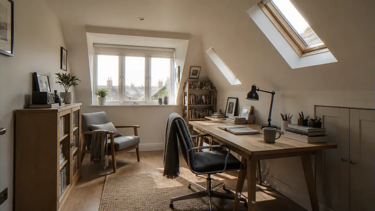
Dormer, rooflight and rear extension CGI for Tyneside flats, the late Victorian streets of South Jesmond and the period houses of Gosforth.
Loft Conversion CGI of a Dormer Study with Rooflights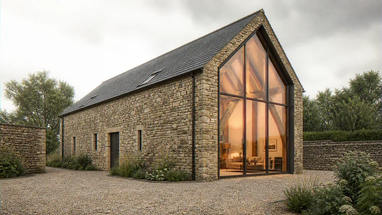
Barn and farmhouse conversions
Heritage conversion CGI for stone barns and farm buildings in rural Northumberland, showing new glazing set into the existing openings.
Heritage Conversion CGI of a Listed Stone Barn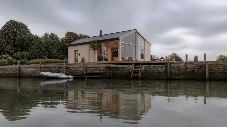
Riverside and Ouseburn schemes
Waterside CGI for homes, conversions and workspaces along the Tyne, where the Quayside and the Lower Ouseburn Valley carry an industrial and riverside setting.
Waterfront CGI of a Quayside House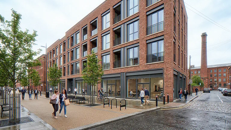
City-centre offices and mixed use
Office, retail and mixed-use CGI for Urban Core sites such as the Stephenson Quarter beside Central Station and the East Pilgrim Street area.
Commercial CGI of a Mixed-Use Corner BlockThe quote follows the camera count and level of detail of the closest example.
Newcastle and North East Council Areas Covered
The Newcastle service covers all seven council areas of the North East Combined Authority. Each town sits under the council that decides its planning applications.
Newcastle upon Tyne
- City Centre and Quayside
- Jesmond
- Gosforth
- Ouseburn
Gateshead
- Gateshead
- Gateshead Quays
North Tyneside
- North Shields
- Wallsend
- Whitley Bay
- Tynemouth
South Tyneside
- South Shields
- Jarrow
- Hebburn
Sunderland
- Sunderland
- Washington
- Houghton-le-Spring
Northumberland
- Hexham
- Morpeth
- Cramlington
- Ponteland
- Blyth
- Alnwick
County Durham
- Durham
- Chester-le-Street
- Consett
Beyond the North East
For sites further south, see 3D architectural visualisation in Leeds and architectural CGI in Yorkshire. The UK-wide architectural visualisation page covers projects elsewhere in Britain.
Newcastle CGI Workflow in Five Steps
A Newcastle CGI commission moves through five steps, and the chosen package fixes the render count, the resolution and the revision rounds.
- 1
Share the drawings
Plans, elevations and sections in PDF, DWG or another CAD format, with site photographs and material references.
- 2
Agree a fixed quote
The quote states the package, each camera view and the delivery date.
- 3
Check the draft model
Draft views confirm massing, materials and camera angles before final rendering starts.
- 4
Return revision notes
The package sets the revision rounds at one, two or three.
- 5
Download the final images
Final renders arrive at 2K, 3K or 4K resolution, set by the package.
The architectural CGI price calculator estimates the cost from the chosen package and options, and the CGI workflow page explains each stage in more detail.
Newcastle Architectural CGI Questions
Which council decides a planning application near Newcastle?
Newcastle City Council decides applications inside the city boundary. Gateshead, North Tyneside, South Tyneside, Sunderland, Northumberland and County Durham councils decide them in their own areas, and Northumberland National Park has its own planning authority. The CGIs go in with the drawings to the authority that covers the site.
Can CGI support an application in a Newcastle conservation area?
Yes. Illustrative CGIs and photomontages go in as supporting images with the planning drawings for sites in any of the city's 12 conservation areas, such as Central, Summerhill, Leazes or Gosforth. A verified photomontage is prepared when the planning authority asks for accurate views and survey data for the site exists.
How long does architectural CGI take for a North East project?
Delivery takes 5 to 6 days for two renders, 7 to 10 days for four renders and 16 to 17 days for eight renders, set by the package. The delivery time starts once the drawings and material references are complete.
Is a site visit needed for a project in Newcastle or Northumberland?
No. Work begins from the plans, elevations and sections alone, because the 3D model is built from those drawings. A photomontage takes its real setting from site photographs supplied by the client or a surveyor.
Request a Quote for a Newcastle Project
Send the drawings and the site address for a fixed quote on exterior, interior, aerial or planning CGI in Newcastle and the North East.
Monday to Friday, 9AM to 6PM
Newcastle Project Contact
Phone
+44 1227 947175
Newcastle and North East enquiries
hello@visuarchitect.com
24hr response
Meetings
Video calls
3D model reviews on screen